
Hazard Maps
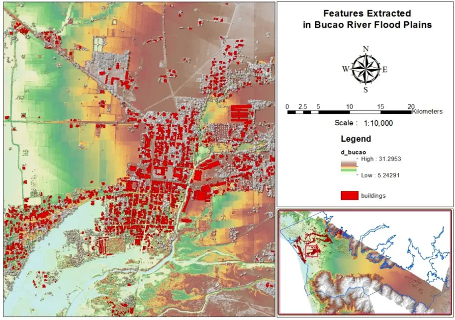
Buildings and Infrastructures inside the floodplain of Bucao River Basin.
____
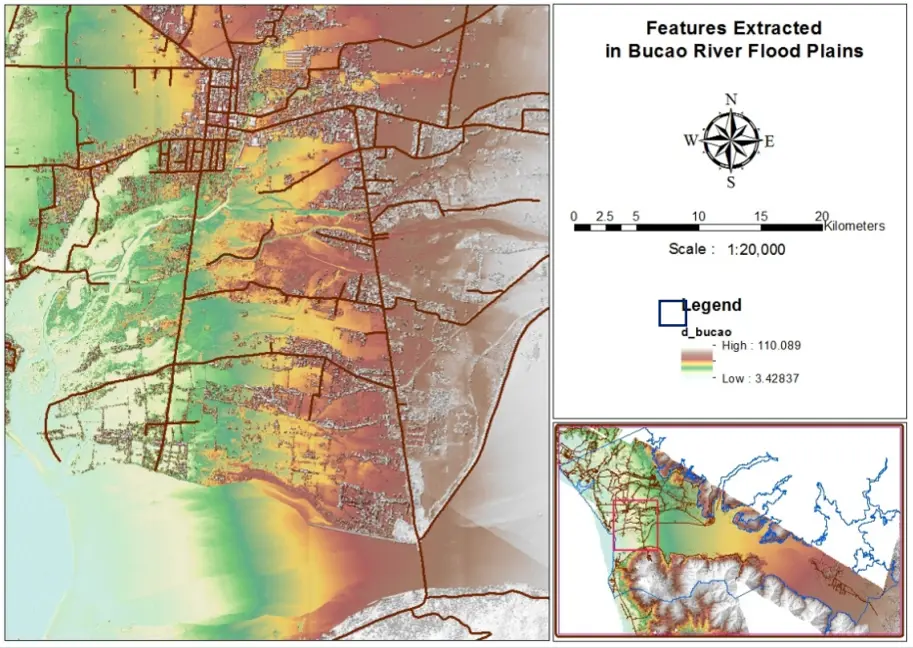
Road networks inside the floodplain of Bucao River Basin.
____
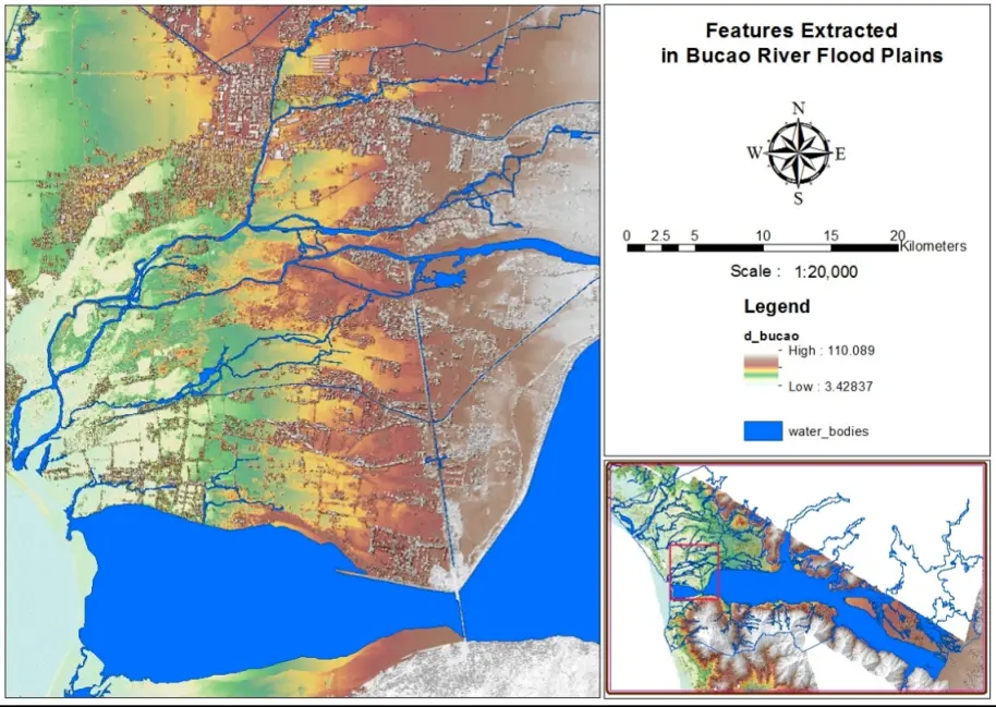
Water Bodies inside the floodplain of Bucao River Basin.
____
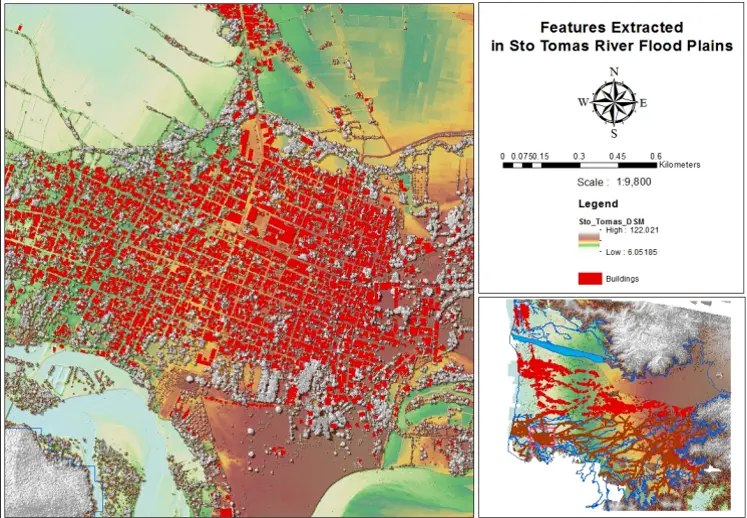
Buildings and Infrastructures inside the floodplain of Sto. Tomas river basin.
____
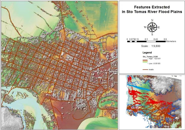
Road networks inside the floodplain of Sto. Tomas river basin.
____
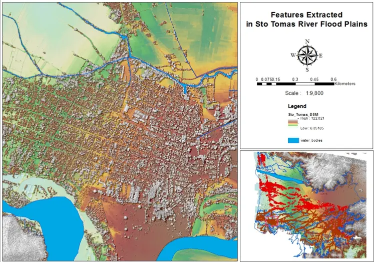
Water Bodies inside the floodplain of Sto. Tomas River Basin.
____
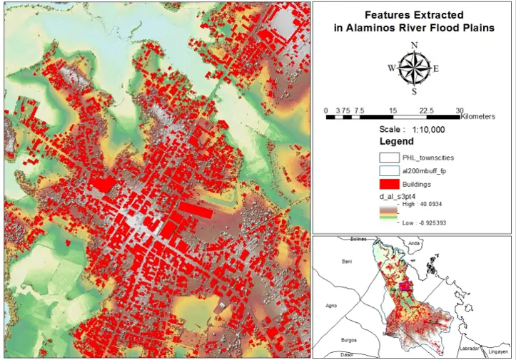
Buildings and Infrastructures inside the floodplain of Alaminos river basin.
____
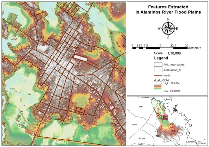
Road networks inside the floodplain of Alaminos River basin.
____
Water Bodies inside the floodplain of AlaminosRiver Basin.

____
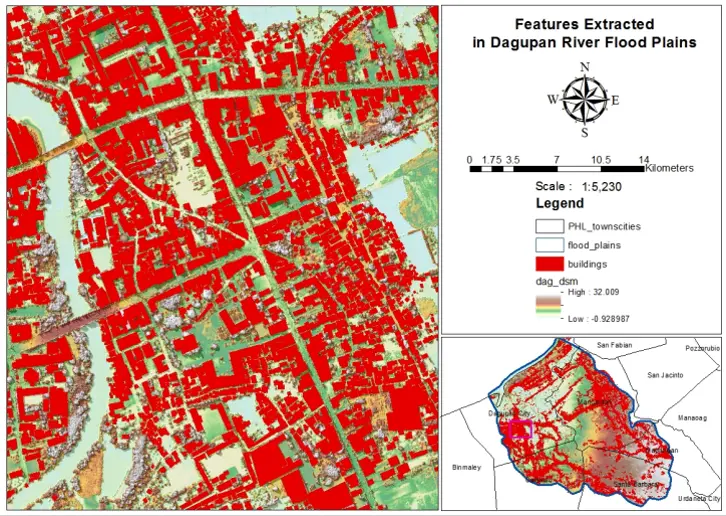
Buildings and Infrastructures inside the floodplain of Dagupan (Sinocalan) river basin.
____
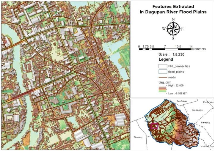
Road networks inside the floodplain of Dagupan (Sinocalan) River basin .
____
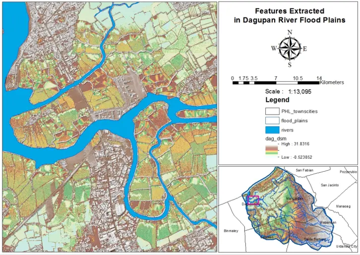
Water Bodies inside the floodplain of Dagupan (Sinocalan) River Basin.
____
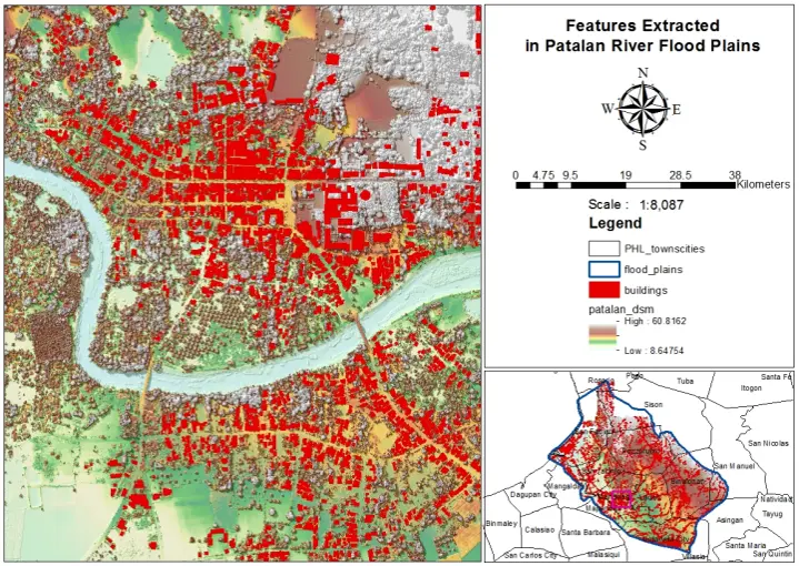
Buildings and Infrastructures inside the floodplain of Patalan (Bued-Angalacan) river basin.
____
Road networks inside the floodplain of Patalan (Bued-Angalacan) River basin.
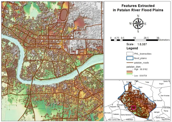
____
Water Bodies inside the floodplain of Patalan (Bued-Angalacan) River Basin.
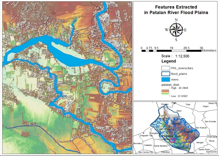
____
Buildings and Infrastructures inside the floodplain of Morong river basin.
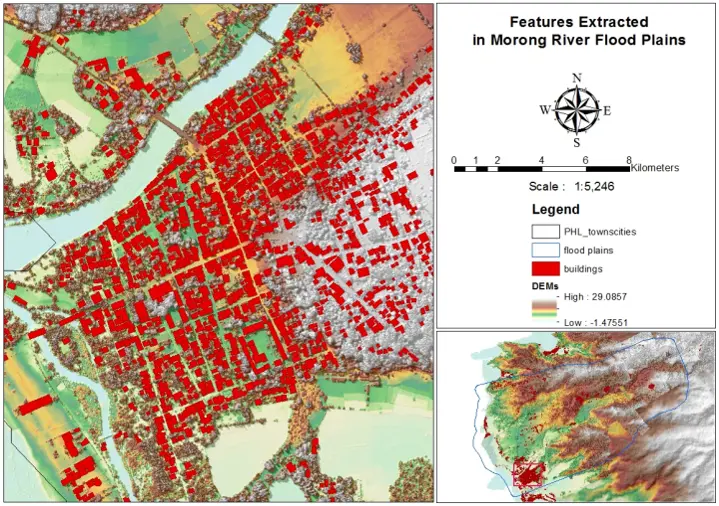
____
Road networks inside the floodplain of Morong River basin.
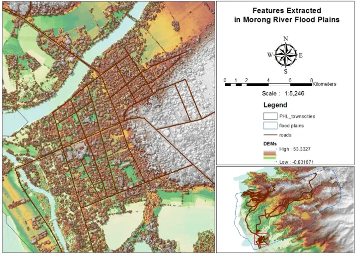
____
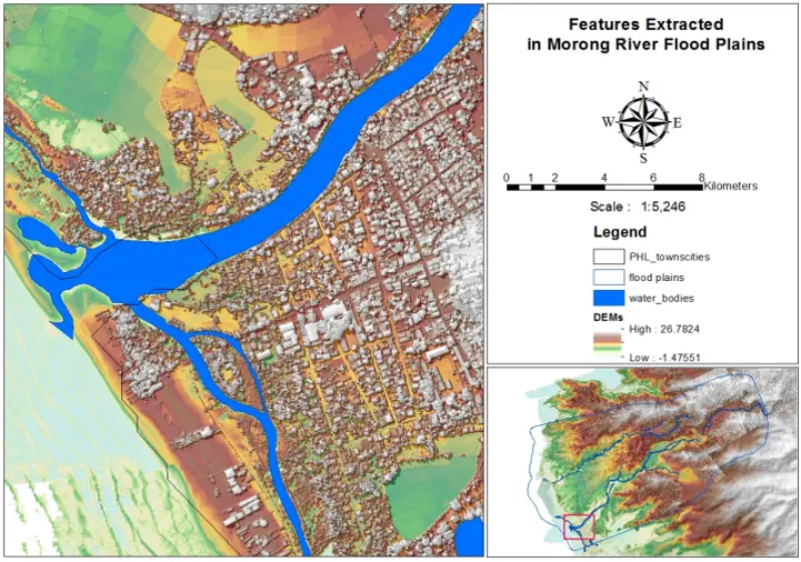
Water Bodies inside the floodplain of Morong River Basin.
____
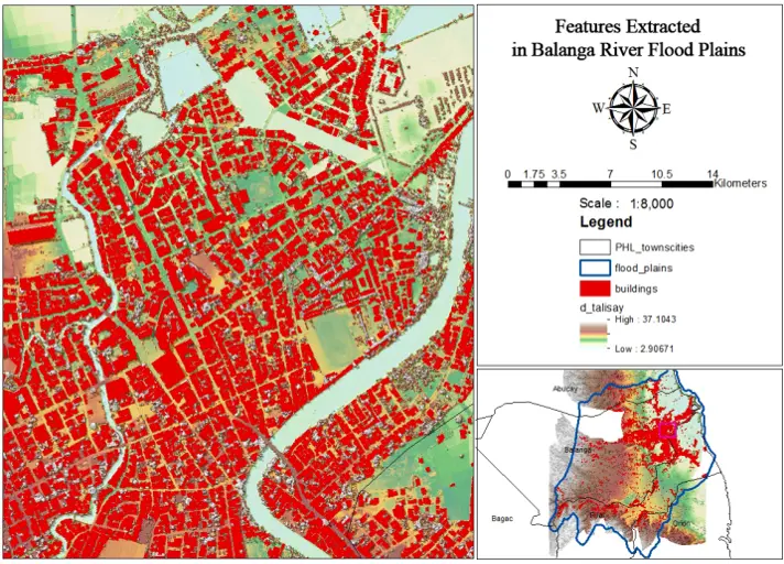
Buildings and Infrastructures inside the floodplain of Balanga (Talisay) river basin.
____
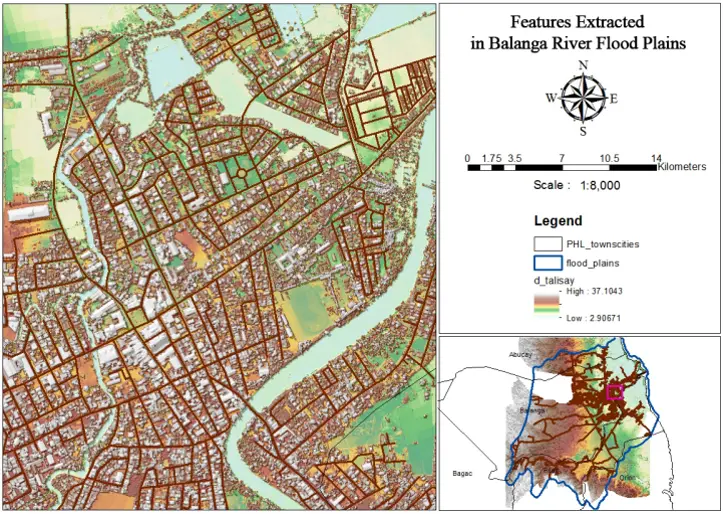
Road networks inside the floodplain of Balanga (Talisay) River basin.
____
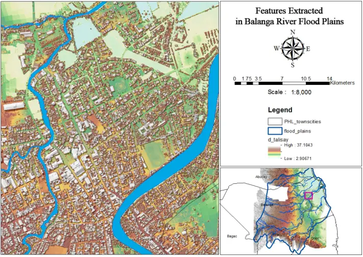
Water Bodies inside the floodplain of Balanga (Talisay)River Basin.
____
Buildings and Infrastructures inside the floodplain of Umiray river basin.
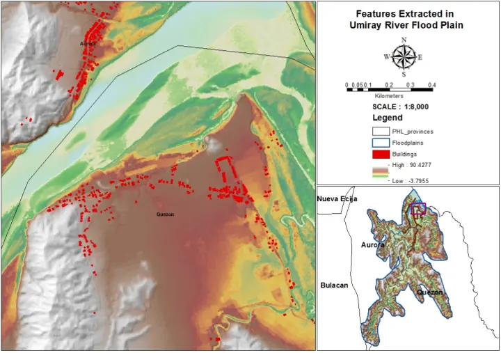
____
Road networks inside the floodplain of Umiray River basin.
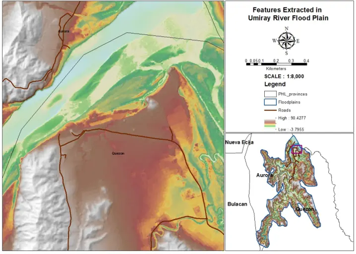
____
Water Bodies inside the floodplain of Umiray River Basin.
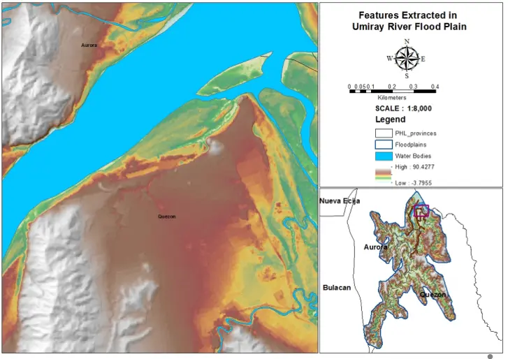
____
Geographic Information System Assisted Flood Hazard Mapping
Solving river engineering problems typically requires river flow characterization, including the prediction of flow depth, flow velocity, and flood extent. Hydraulic models use governing equations of the flow in motion (conservation of mass and momentum principles) to predict the flow characteristics. The method of generating flood hazard maps display flood hazard information that could be used in development and risk reduction planning in Central Luzon and Pangasinan. The study further develop a methodology in generation of Bucao River Watershed (BRW), Santo Tomas River Watershed (STRW), Patalan River Watershed (PRW), Dagupan River Watershed (DRW), Alaminos River Watershed (ARW), Morong River Watershed (MRW) and Balanga River Waterhsed (BRW) flood hazard maps and identification of flood susceptible areas within each watersheds using the spatial analyst integrated in Geographic Information System (GIS)
Simulated flood depth map of Bucao River Basin for a 5-year rainfall event.
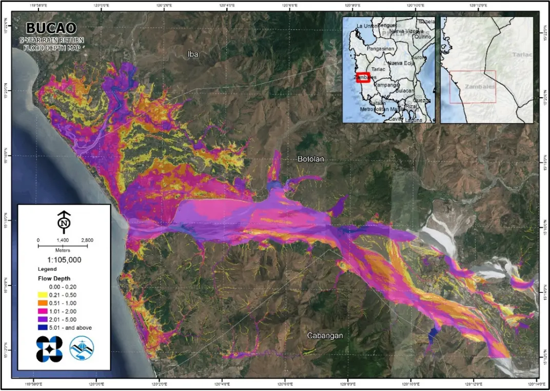
____
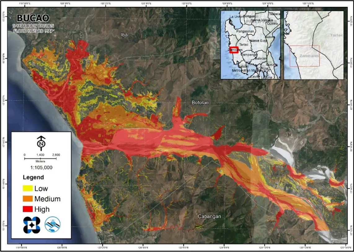
Geographic Information System Assisted Flood Hazard Mapping
Simulated flood hazard map of Bucao River Basin for a 5-year rainfall event.
____
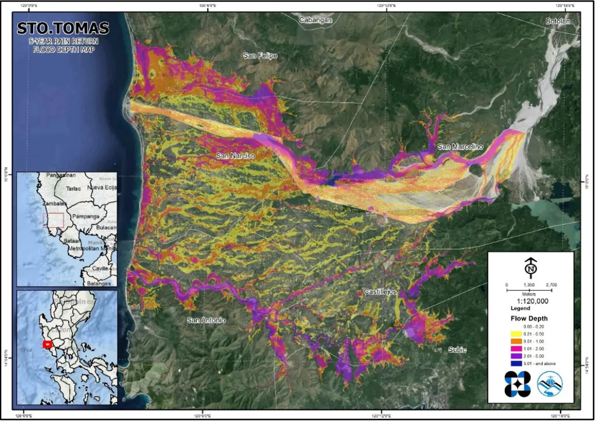
Geographic Information System Assisted Flood Hazard Mapping
Simulated flood depth map of Santo Tomas River Basin for a 5-year rainfall event.
____
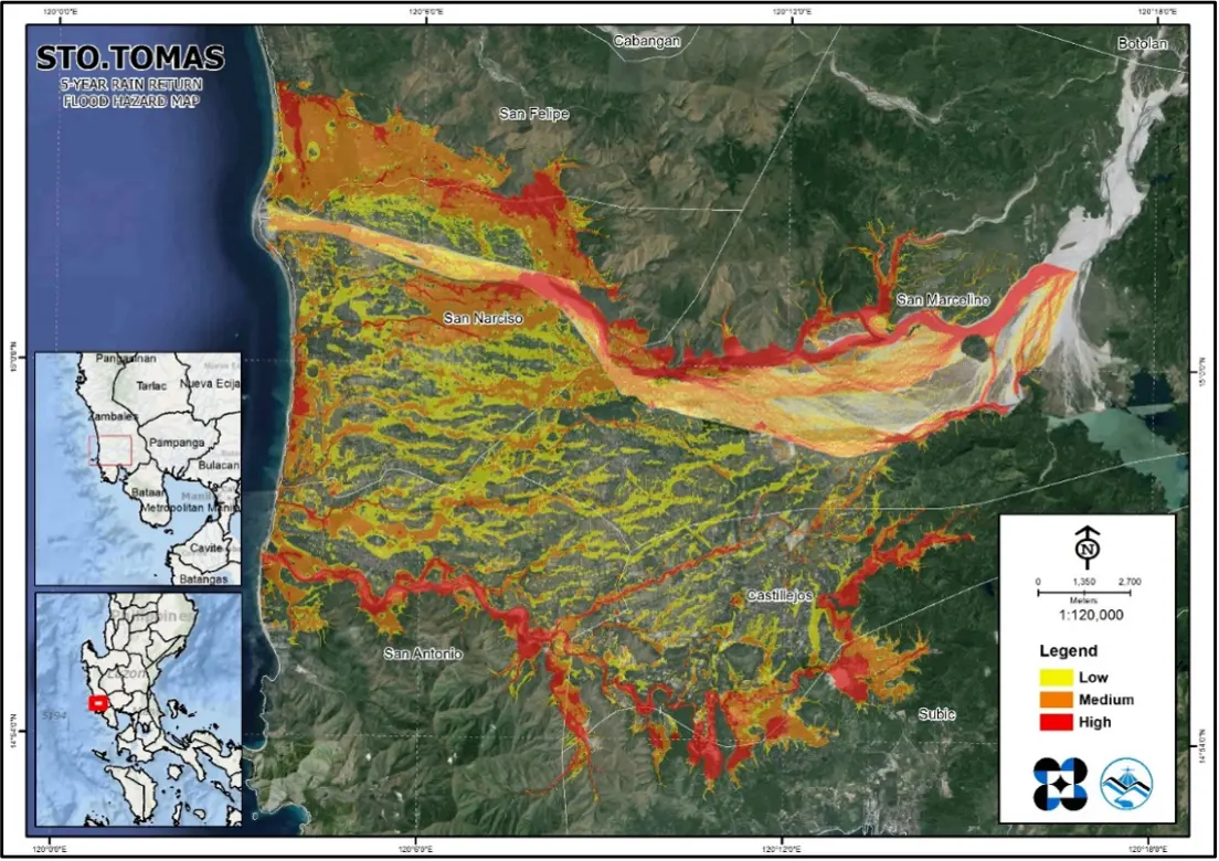
Geographic Information System Assisted Flood Hazard Mapping
Simulated flood hazard map of Santo Tomas River Basin for a 5- year rainfall event.
____
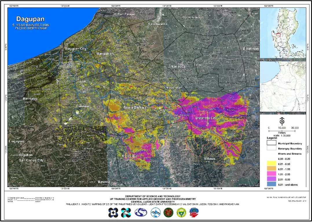
Geographic Information System Assisted Flood Hazard Mapping
Simulated flood depth map of Dagupan (Sinocalan) River Basin for a 5-year rainfall event.
____
Geographic Information System Assisted Flood Hazard Mapping
Simulated flood hazard map of Dagupan (Sinocalan) River Basin for a 5-year rainfall event.
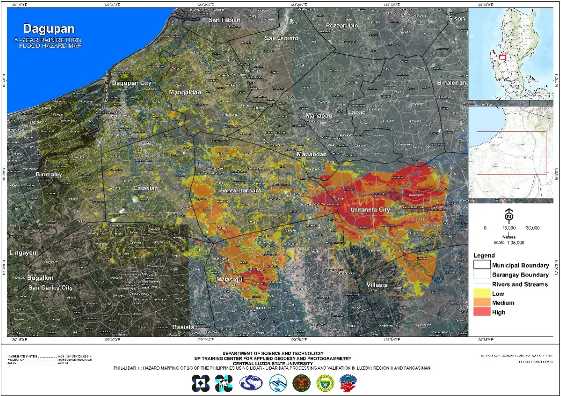
____
Geographic Information System Assisted Flood Hazard Mapping
Simulated flood depth map of Patalan (Bued-Angalacan) River Basin for a 5-year rainfall event.
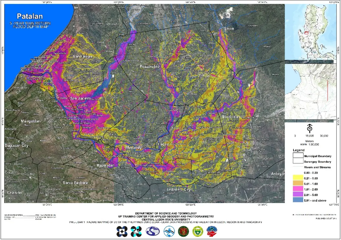
____
Geographic Information System Assisted Flood Hazard Mapping
Simulated flood hazard map of Patalan (Bued-Angalacan) River Basin for a 5-year rainfall event.
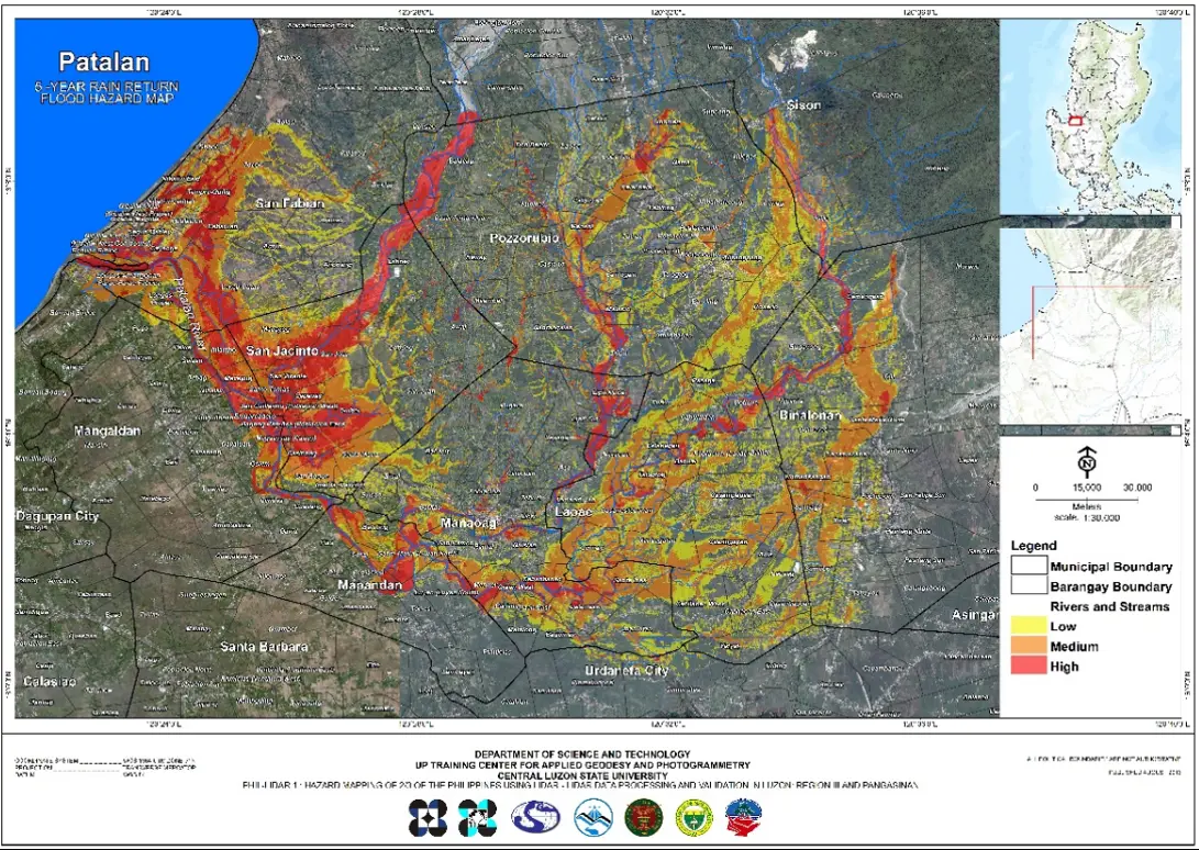
____
Geographic Information System Assisted Flood Hazard Mapping
Simulated flood depth map of Alaminos river basin for a 5-year rainfall event.
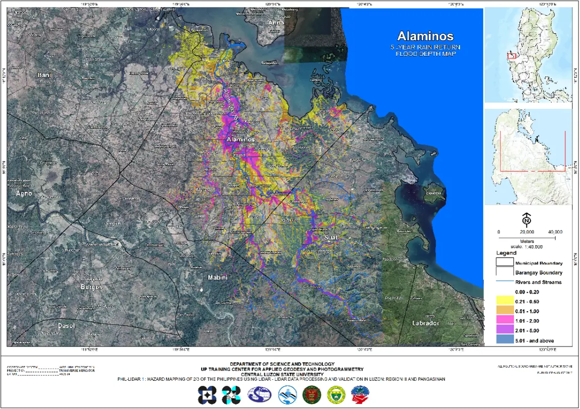
____
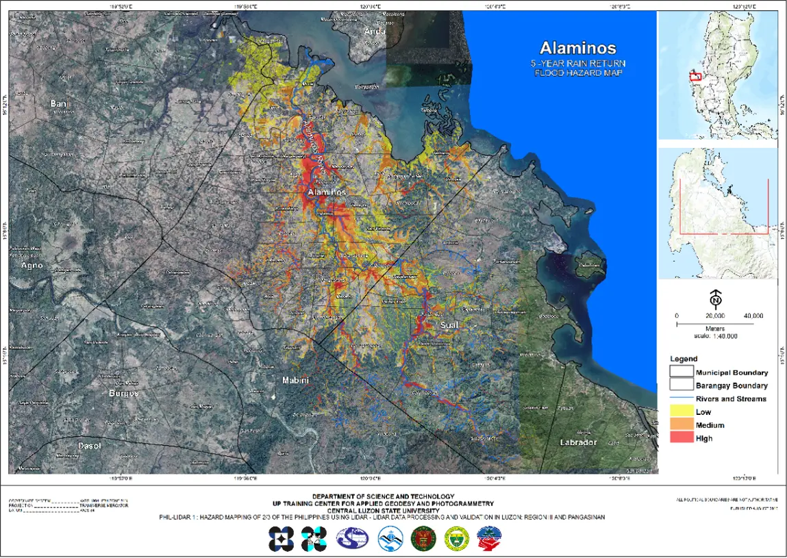
Geographic Information System Assisted Flood Hazard Mapping
Simulated flood hazard map of Alaminos river basin for a 5-year rainfall Event.
____
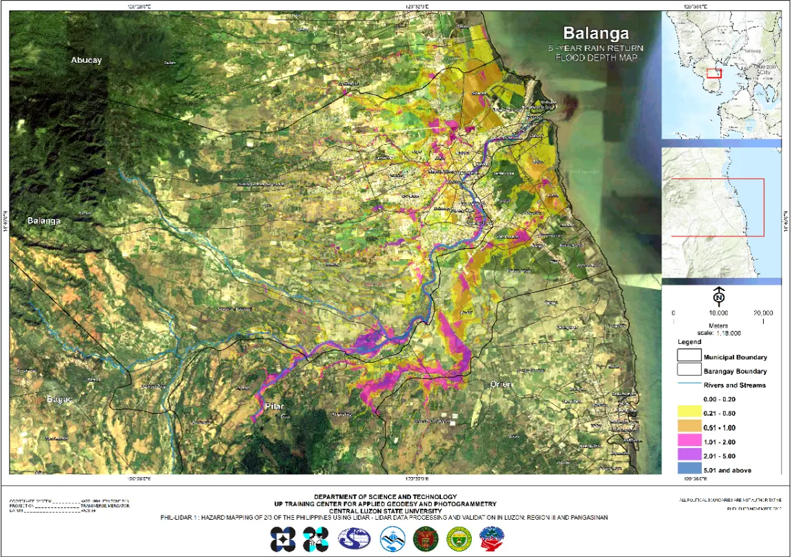
Geographic Information System Assisted Flood Hazard Mapping
Simulated flood depth map of Balanga (Talisay) river basin for a 5-year rainfall event.
____
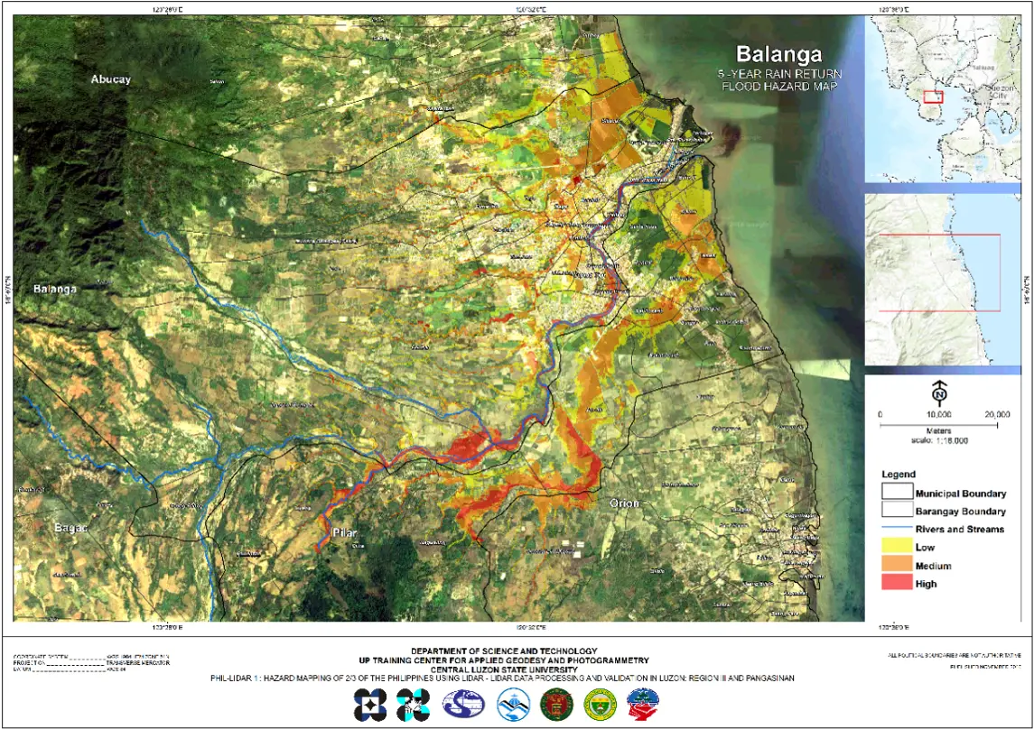
Geographic Information System Assisted Flood Hazard Mapping
Simulated flood hazard map of Balanga (Talisay) river basin for a 5- year rainfall event.
____
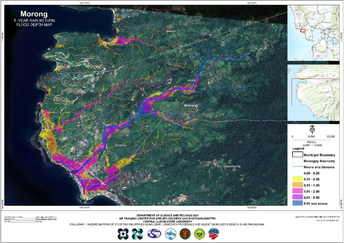
Geographic Information System Assisted Flood Hazard Mapping
Simulated flood depth map of Morong river basin for a 5-year rainfall event.
____
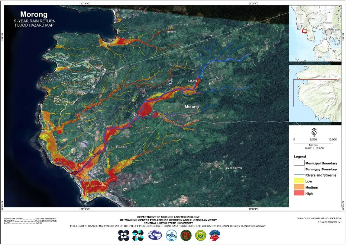
Geographic Information System Assisted Flood Hazard Mapping
Simulated flood hazzard map of Morong river basin for a 5-year rainfall event.
____
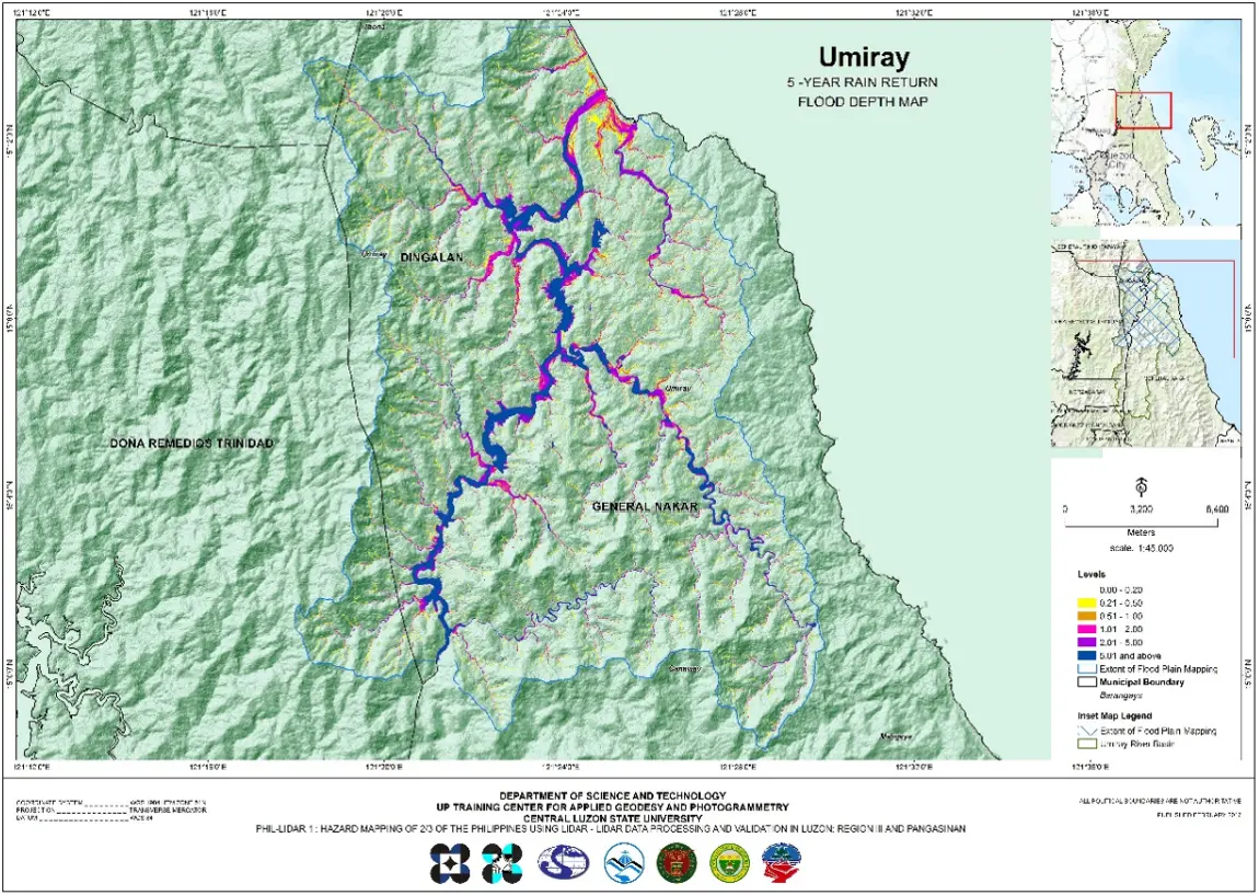
Geographic Information System Assisted Flood Hazard Mapping
Simulated flood depth map of Umiray river basin for a 5-year rainfall event.
____
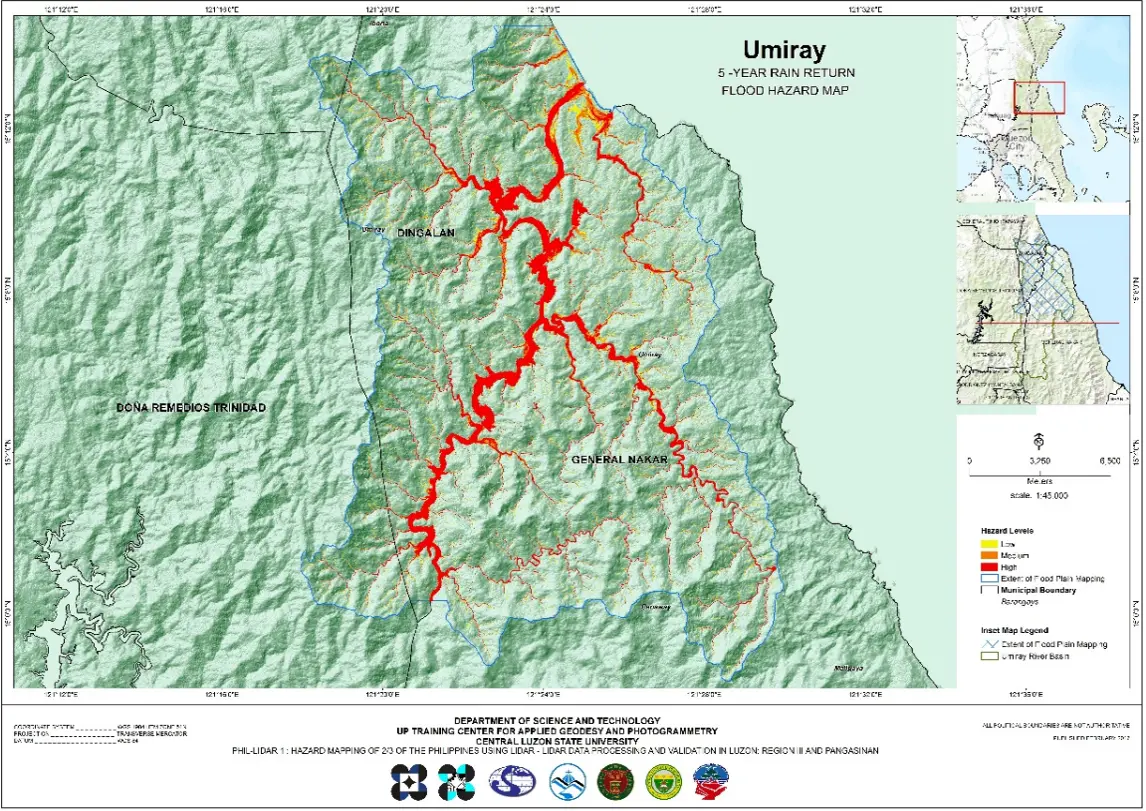
Geographic Information System Assisted Flood Hazard Mapping
Simulated flood hazzard map of Umiray river basin for a 5-year rainfall event.
____